-40%
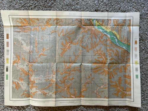
1902 Alkali Soil Map Iowa Illinois Dubuque Sheet Bureau Of Soils US Agriculture
$ 13.19
- Description
- Size Guide
Description
ANTIQUE MAPUS Department of Agriculture Bureau of Soils
Original Soil Map dated 1902
Suitable for framing
Measures approximately 30"
wide 20" height including margins
Folded measures approx 9" X 5 3/4"
Iowa & Illinois
Includes:
Dubuque
Taylor
Vernon
Mosalem
Table Mound
Whitewater
Prairie Creek
Washington
Prairie Spring
Tente De Mort
Richland
Dunleith
Menominee
Mississippi River
+More
Ships in a rigid photo mailer
Soil Survey Map is over 100 years old - Paper shows yellowing/foxing consistent with age, may have some minor crease/fold line pin holes or tears, some edge or margin tears possible. Please review pictures. Item in photo is actual item you will receive!


